

Iraq’s meteorological authority announced Tuesday that the country will experience scattered rainfall and dust activity over the coming days, with variable conditions expected across northern, central, and southern regions. The authority’s forecast indicates partial cloud cover with light precipitation in northern areas Wednesday through Friday, with Thursday bringing clearer skies and rising temperatures. Saturday will bring increased cloud cover with thunderstorms in scattered areas and strong southeastern winds reaching 50 kilometers per hour in southern regions, creating significant dust activity and reducing visibility. The meteorological outlook shows a transition from relatively stable weather conditions toward more unstable atmospheric patterns as the week progresses.
The forecast reflects typical spring weather patterns for Iraq, with competing air masses creating variable conditions and the potential for both precipitation and dust storms depending on geographic location and time of day.
Wednesday Weather – Stable Conditions with Light Precipitation in North
Regional Cloud Cover and Temperature Distribution
Wednesday’s weather will bring clear to partly cloudy skies in central and southern regions, with partial to fully cloudy conditions in the north where light rainfall is possible. Temperature readings will remain comparable to Tuesday levels across all regions, reflecting continued seasonal warming without extreme daily fluctuations.
Maximum Temperatures by Region Wednesday
The meteorological authority forecast the following maximum temperatures for Wednesday across Iraq’s major cities and regions:
Northern regions (Sulaymaniyah, Dohuk): 20°C Erbil: 21°C Nineveh: 23°C Kirkuk: 24°C Salah ad-Din and Anbar: 26°C Baghdad and Diyala: 27°C Babylon, Karbala, and Najaf: 28°C Wasit, Diwaniyah, and Muthanna: 29°C Maysan and Dhi Qar: 30°C Basra: 31°C
The temperature distribution reflects the typical north-to-south warming gradient characteristic of Iraq’s geography, with cooler northern mountainous regions and warmer southern plains.
Precipitation Probability and Humidity
Light rainfall is expected primarily in northern regions Wednesday, with very low probability in central and southern areas. Horizontal visibility will remain good at 8-10 kilometers under clear conditions, declining to 5-7 kilometers in rainfall areas where moisture content increases.
Thursday Weather – Clearing Skies and Rising Temperatures
Widespread Clearing Pattern
Thursday brings improvement in weather conditions across the entire nation, with predominantly clear to partly cloudy skies expected throughout Iraq. The clearing pattern indicates departure of moisture-bearing systems and establishment of drier air masses over the region.
Temperature Increase Thursday
Temperatures will rise modestly across all regions Thursday, reflecting both the clearing of cloud cover and continued seasonal warming as spring progresses toward summer. The rise will be most pronounced in areas that experienced cloud cover and potential precipitation Wednesday, where sunlight penetration increases once clouds disperse.
Wind and Visibility Thursday
Winds will remain light to moderate with little significant activity, maintaining good horizontal visibility at 8-10 kilometers across clear areas. The relatively stable atmospheric conditions Thursday offer optimal opportunity for outdoor activities and operations before unsettled weather returns Friday and Saturday.
Friday Weather – Increased Clouds and Northern Precipitation
Return of Cloud Cover
Friday brings return of partial to fully cloudy conditions in scattered areas, signaling renewed moisture availability and atmospheric instability. The cloud cover will concentrate in northern and western regions while central and southern areas remain relatively clearer.
Rainfall Distribution Friday
Light rainfall is expected primarily in northern regions and western sections of the country Friday, continuing the trend of precipitation concentrating in higher elevation areas where moisture-bearing systems preferentially deposit moisture. Southern and central plains will remain largely dry.
Temperature and Visibility Friday
Temperatures will increase moderately Friday, particularly in central and northern regions where warming will be more pronounced. The increases reflect continued seasonal trend toward warmer temperatures as spring advances. Horizontal visibility will remain acceptable at 8-10 kilometers under normal conditions, declining to 5-7 kilometers in rainfall areas.
Saturday Weather – Thunderstorms and Strong Dust Winds in South
Increased Instability and Storm Potential
Saturday brings the most unsettled weather conditions of the forecast period, with partial to fully cloudy skies and scattered light to moderate rainfall that becomes thunderstorm activity in some areas. The atmospheric instability pattern suggests competing air masses and potential for localized severe weather.
Southeastern Wind Activity and Dust Generation
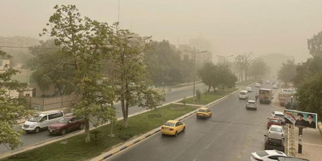
Saturday’s most significant weather feature will be strong southeastern winds in southern regions, reaching speeds of 50 kilometers per hour particularly during afternoon hours. These strong winds will cause substantial dust activity in affected areas, significantly reducing visibility and creating hazardous conditions for transportation and outdoor operations.
The wind pattern reflects passage of a pressure system with strong pressure gradient in southern regions, typical of spring weather systems in Iraq that combine dust generation with precipitation potential.
Saturday Visibility and Hazards
Horizontal visibility will decline substantially Saturday in areas experiencing dust activity, ranging from 6-8 kilometers under normal conditions but dropping to 4-6 kilometers in dust and rainfall zones. Combined dust and precipitation can create particularly hazardous conditions for drivers and operators, requiring heightened caution.
Temperature Stability Saturday
Temperatures Saturday will remain comparable to Friday levels, reflecting the moderating effect of cloud cover and precipitation on maximum temperature development. The clouds and rainfall limit solar radiation penetration and surface heating.
Seasonal Weather Patterns and Atmospheric Dynamics
Spring Transition Characteristics
The forecast reflects typical spring weather transition in Iraq, characterized by competing subtropical high pressure systems and temperate low pressure systems. The alternation between clear, stable conditions and cloudy, unstable conditions is seasonal norm as atmosphere adjusts to increasing solar heating.
Regional Vulnerability to Weather Variability
Northern mountainous regions remain most prone to precipitation due to topographic enhancement of moisture flow, while southern plains experience minimal rainfall. Dust activity concentrates in southern and western regions where winds are less obstructed and surface conditions more conducive to dust generation.
Implications for Agricultural and Infrastructure Operations
The variable weather pattern has implications for agriculture with Friday and Saturday precipitation providing beneficial soil moisture, though strong Saturday winds create dust hazard for field operations. Transportation networks in southern regions will require heightened alert Saturday due to visibility reduction from dust activity.
Meteorological Authority Guidance and Safety Recommendations
Travel and Transportation Precautions
Drivers should exercise caution Friday evening and particularly Saturday during afternoon hours when wind speeds peak in southern regions. The combination of dust and potential precipitation Saturday creates compound visibility hazard requiring reduced speeds and increased following distances.
Outdoor Activity Planning
Friday represents optimal day for outdoor activities across most regions with clearing skies and rising temperatures. Saturday’s dust winds and thunderstorm potential suggest rescheduling outdoor activities in southern regions or implementing weather-appropriate precautions.
Power System and Infrastructure Considerations
Strong Saturday winds reaching 50 kilometers per hour may stress electrical transmission and distribution systems, potentially causing outages in southern regions where wind exposure is greatest. Wind-sensitive infrastructure should be secured Friday in anticipation of Saturday conditions.
Conclusion:
Iraq’s meteorological authority forecasts a week of variable weather with clear, warm conditions Wednesday through Thursday transitioning to increased cloud cover and precipitation Friday with strongest activity Saturday morning. Wednesday and Thursday offer stable conditions suitable for most outdoor operations, with temperatures rising gradually from 20-31°C Wednesday to slightly higher levels Thursday. Friday brings return of cloud cover with light precipitation in northern regions and modest temperature increases. Saturday represents the most unsettled weather day with thunderstorms in scattered areas and strong southeastern winds reaching 50 kilometers per hour in southern regions, generating significant dust activity and reducing visibility to 4-6 kilometers in affected areas. The forecast reflects typical spring atmospheric patterns in Iraq where competing air masses create alternating periods of stability and instability. Travelers, agricultural operators, and infrastructure managers should monitor weather updates Saturday morning as conditions develop and adjust operations accordingly for safety.


