
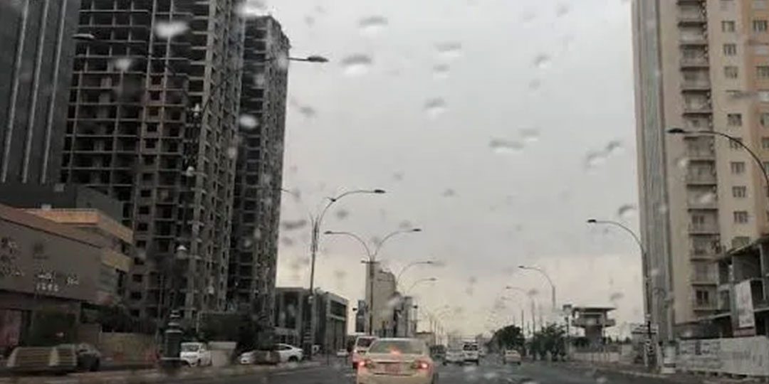

Iraq’s meteorology authority issued detailed weather forecasts Wednesday predicting thunderstorms accompanied by lightning and rain beginning Saturday, April 19, affecting central and southern regions. The expected precipitation follows a period of relatively clear conditions with temperatures reaching into the low 30s Celsius across southern provinces. Residents should prepare for variable weather conditions including gusty winds and reduced visibility during rainfall periods.
Thursday Forecast: Cloudy Conditions and Dust
Regional Cloud Coverage
Thursday will bring cloudy conditions to central and southern Iraq with partly cloudy skies across the northern region. Northwestern winds will blow at light to moderate speeds, with gusts reaching 40 kilometers per hour in southern areas, potentially causing dust stirred upward in localized areas. Horizontal visibility will range from 8-10 kilometers normally, reducing to 5-7 kilometers during dust conditions.
Temperature Patterns Thursday
Maximum temperatures Thursday will vary significantly across Iraq’s geographic regions:
- Northern provinces: Dohuk 21C, Erbil 22C, Sulaimaniyah and Nineveh 23C
- Central regions: Kirkuk 25C, Diyala 26C, Salah ad-Din, Anbar, and Wasit 27C, Baghdad and Karbala 28C
- Southern provinces: Babylon 29C, Najaf and Diwaniyah 30C, Dhi Qar and Muthanna 31C, Basra 32C
Temperatures will rise slightly in central and northern regions compared to Wednesday, while southern areas will experience similar conditions to the previous day.
Friday Outlook: Increasing Cloud Cover and Light Rainfall
Scattered Rainfall Expected
Friday will feature partly cloudy skies transitioning to fully overcast conditions across central and southern Iraq. Light to moderate rainfall is expected over western sections of these regions during nighttime hours. Northern Iraq will remain partly cloudy without significant precipitation.
Temperatures will rise several degrees across all regions compared to Thursday, continuing seasonal warming trends. Horizontal visibility will remain good at 8-10 kilometers in clear areas, reducing to 3-5 kilometers during rainfall periods.
Saturday: Main Weather System Arrives With Thunderstorms
Thunderstorm Development
Saturday will bring the primary weather system, with generally overcast skies and moderate-intensity rainfall accompanied by lightning and thunder in some locations. Central Iraq regions will experience heavy rainfall in localized areas during nighttime hours, while southern and northern regions face moderate precipitation.
Southeasterly winds will blow at moderate speeds, gusting to 40 kilometers per hour, with occasional intensification to 50 kilometers per hour in central and southern areas where wind will cause dust stirring. This combination of rain and wind may create hazardous conditions requiring caution during travel.
Saturday Visibility Conditions
Horizontal visibility will diminish to 6-8 kilometers during the day, further reducing to 2-4 kilometers during rainfall and dust events. Travelers and outdoor workers should exercise caution during periods of poor visibility when rain and wind coincide.
Saturday Temperature Patterns
Northern regions will experience temperatures similar to Friday levels, while central and southern Iraq will see slight warming despite cloud cover and precipitation.
Sunday: Persistent Rainfall and Temperature Decline
Sunday Precipitation Distribution
Sunday will feature cloudy skies across northern and southern Iraq with moderate-intensity rainfall expected throughout both regions. Central Iraq will transition from partly cloudy to overcast conditions, with moderate rainfall and thunderstorms developing in eastern sections.
Temperature Trends
Temperatures will decline several degrees across all Iraq regions compared to Saturday, as persistent cloud cover and rainfall dampen daytime warming. This cooling trend follows the passage of the main weather system.
Sunday Visibility Conditions
Horizontal visibility will improve to 8-10 kilometers during non-rainy periods, reducing to 3-5 kilometers during active precipitation. Sunday’s visibility should remain better than Saturday despite continuing rainfall.
Regional Rainfall Intensity Variations
Central Iraq Focus
Central regions from Baghdad westward will experience the heaviest rainfall concentrations, with localized heavy precipitation possible during nighttime hours Saturday and continuing into Sunday morning. Eastern central areas will feature more pronounced thunderstorm activity.
Southern Region Characteristics
Southern Iraq including Basra, Dhi Qar, Muthanna, and Najaf provinces will receive moderate rainfall without the heavy localized concentrations expected in central regions. Southern areas will face stronger wind conditions, with gusts potentially reaching 50 kilometers per hour in some locations.
Northern Region Expectations
Northern Iraq including Kurdish-controlled regions will experience relatively lighter rainfall compared to central areas. Sulaimaniyah and surrounding mountainous areas may receive somewhat heavier precipitation due to orographic effects, though this will remain moderate compared to central Iraq.
Wind and Dust Considerations
Wind Speed Escalation
Southeasterly winds Saturday will begin at moderate speeds around 40 kilometers per hour before intensifying to 50 kilometers per hour in central and southern regions. This wind acceleration creates dangerous conditions when combined with rainfall reducing visibility to 2-4 kilometers.
Dust Stirring Potential
Wind speeds will prove sufficient to stir dust from arid regions, particularly in southern provinces and western areas of central Iraq. This dust stirring will particularly affect visibility during late afternoon and early evening Saturday before evening rainfall begins.
Practical Recommendations for Residents
Transportation Safety
Motorists should reduce speeds and increase following distances during periods of heavy rain and wind gusts Saturday. Routes across central Iraq heading toward western border regions will face the greatest hazard from combined rain and dust conditions.
Outdoor Activities
Outdoor workers and travelers planning activities for this period should monitor weather updates and consider postponing non-essential outdoor work during Saturday afternoon and evening when wind and dust stirring peaks before rainfall begins.
Agricultural and Infrastructure Implications
The expected rainfall will provide precipitation for agricultural areas after weeks of drier conditions. Infrastructure managers responsible for water drainage systems should prepare for increased runoff Saturday and Sunday as moderate rainfall accumulates across multiple hours.
Conclusion:
Iraq’s meteorology authority has issued clear warnings of significant weather system development beginning Saturday with thunderstorms, lightning, and moderate to locally heavy rainfall affecting central and southern regions. The system will bring both precipitation benefits and temporary disruptions from wind, dust, and reduced visibility. Residents should prepare for variable conditions through Sunday morning, with particular caution advised for Saturday when heavy rain coincides with strong southeasterly winds. The cooling temperatures following the weather system’s passage and improved visibility Sunday will mark the system’s conclusion. Iraqi residents and authorities should monitor ongoing weather updates as the system develops, particularly regarding localized heavy rainfall amounts in central regions that could impact infrastructure or create localized flooding in low-lying areas.